Image default
SC

The 2023 Hurricane Season Is Here

What do the tropics have in store for us?

Global warming alarmists might want to up the dosage on their chill pills this summer as forecasters with the National Oceanic and Atmospheric Administration (NOAA)’s climate prediction center called for a “near-normal” season in the Atlantic basin.

According to NOAA, there will be an estimated 12 to 17 named storms this year. Of those systems, five to nine storms will be hurricanes (with winds at or above 74 miles per hour) and one to four will be major hurricanes (with winds at or above 111 miles per hour).

In addition to issuing its projections, NOAA boasted of having better “data and expertise” this season – driven by a 20 percent expansion of its supercomputing system. The agency also unveiled a new Hurricane Analysis and Forecast System (HAFS) which it claims will provide a 10-15 percent improvement in tracking forecasts over current models once it is operational this summer.

“We are operationalizing a new hurricane forecast model and extending the tropical cyclone outlook graphic from five to seven days, which will provide emergency managers and communities with more time to prepare for storms,” NOAA administrator Rick Spinrad noted.

Support FITSNews … SUBSCRIBE!

***

NOAA is the official projection, but researchers at Colorado State University (CSU) are also calling for a “near-average” season – predicting 15 named storms, seven (7) hurricanes and three (3) major hurricanes. However, CSU researchers noted “conflicting signals” related to the various global weather patterns which impact hurricane formation.

“There is more uncertainty than normal with this outlook,” they wrote in their analysis (.pdf).

For those of you keeping score at home, the current season has already produced two storms. The first was an unnamed disturbance that formed north of Bermuda on January 16, 2023 which was belatedly classified as a subtropical system. The second was Arlene – the first named system of the season. Maxing out with sustained winds of 40 miles per hour, Arlene drifted aimlessly over the eastern Gulf of Mexico before degenerating into a remnant less than 48 hours after forming.

Last year was projected to be another busy hurricane season but it actually produced fewer storms than expected. Unfortunately, those storms wreaked all sorts of havoc – especially Hurricane Ian, which killed an estimated 155 people and did $113 billion in damage after making landfall as a category four storm on Cayo Costa Island in Florida.

(Click to view)

Evacuation route sign on interstate highway. (Getty)

“As we saw with Hurricane Ian, it only takes one hurricane to cause widespread devastation and upend lives,” said administrator Deanne Criswell of the Federal Emergency Management Agency (FEMA). “So regardless of the number of storms predicted this season, it is critical that everyone understand their risk and heed the warnings of state and local officials. Whether you live on the coast or further inland, hurricanes can cause serious impacts to everybody in their path.”

Tropical activity has been on the wane since 2020, which was the most active season since records have been kept in the Atlantic basin. That year brought 30 named storms – of which 14 became hurricanes and seven (7) became major hurricanes. A new record for named storms (11) making landfall in the United States was also established in 2020, while the year tied a record for named storms (10) undergoing “rapid intensification”- i.e. a 35-mile-per-hour increase in maximum sustained winds over a 24-hour period.

Courtesy of our inimitably intrepid research director Jenn Wood, here is some historical perspective on these systems …

Waning tropical activity over the last two years has been attributed to the continued absence of El Niño conditions on the other side of the globe. El Niño is the periodic warming of the central and eastern equatorial regions of the Pacific Ocean – while La Niña refers to the cooling of the Pacific that takes place in its aftermath.

What does water temperature in the Pacific have to do with hurricanes in the Atlantic Ocean?

During El Niño years, hurricanes are less likely to form in the Atlantic due to increased vertical wind shear – or changes in wind speed and direction between 5,000 and 35,000 feet. Vertical wind shear essentially breaks apart developing hurricanes – often preventing them from forming altogether.

“El Niño tends to increase upper-level westerly winds across the Caribbean into the tropical Atlantic,” Colorado State researchers noted in their report. “The increased upper-level winds result in vertical wind shear which can tear apart hurricanes as they try to form.”

During La Niña, the potential for hurricane formation and rapid intensification is much stronger due to reduced vertical wind shear. Basically, calmer conditions make it easier for storms to form – and intensify. After three straight seasons of La Niña, forecasters are predicting El Niño conditions to take hold this summer – which could potentially drive down the number of storms and reduce their intensity.

(Click to view)

On the flip side of that coin, the emergence of El Niño could be “offset by favorable conditions local to the tropical Atlantic Basin,” forecasters warned. Among those conditions? The potential for an above-normal west African monsoon – causing stronger African easterly waves – and warmer sea surface temperatures in both the Atlantic and Caribbean, which could help fuel storm development.

How many hurricanes have hit the Palmetto State over the years?

According to the latest comprehensive hurricane survey (.pdf) from the S.C. Department of Natural Resources (SCDNR), South Carolina has seen 44 tropical cyclones make landfall along its coastline since 1851. Of those systems, only four (4) made landfall as major hurricanes: The 1893 Sea Islands Hurricane, Hurricane Hazel in 1954, Hurricane Gracie in 1959, and Hurricane Hugo in 1989. No category five hurricanes have ever hit the Palmetto State’s 187-mile coastline.

The Palmetto State was nearly hit in 2020 by Hurricane Isaias (or, as governor Henry McMaster called it, Hurricane “Icy Isis”). Other recent close calls included Hurricane Dorian in 2019 and Hurricane Irene in 2011.

Ian was the last hurricane to strike the Palmetto State – making landfall just south of Georgetown as a category one storm on September 30, 2022.

What should you do to get ready for the 2023 season? For starters, be sure to check out the S.C. Emergency Management Division (SCEMD) website – and follow them on Twitter (or wherever you engage on social media). Also, be sure to bookmark the National Hurricane Center (NHC), Weather Underground, Track The Tropics, and the Boat U.S. hurricane tracking and resource center.

All of those are great resources.

Last but not least, be sure to download your copy of the 2023 Hurricane Guide (.pdf), sponsored by Dominion Energy and AARP.

***

THE GUIDE …

(Via: )

***

ABOUT THE AUTHOR …

Will Folks (Brett Flashnick)

Will Folks is the founding editor of the news outlet you are currently reading. Prior to founding FITSNews, he served as press secretary to the governor of South Carolina. He lives in the Midlands region of the state with his wife and seven children.

***

WANNA SOUND OFF?

Got something you’d like to say in response to one of our articles? Or an issue you’d like to proactively address? We have an open microphone policy here at FITSNews! Submit your letter to the editor (or guest column) via email HERE. Got a tip for a story? CLICK HERE. Got a technical question or a glitch to report? CLICK HERE.

***

Get our newsletter by clicking here …

*****

Related posts

SC

South Carolina Elementary School: Air Quality Concerns Led To Teacher Transfers

Callie Lyons
SC

Charleston Police Release Statement, Initial Report On Death Of Boeing Whistleblower

Dylan Nolan
SC

Constitutional Carry Becomes The Law In South Carolina

Dylan Nolan

4 comments

Observer June 4, 2023 at 5:54 pm

Just once, why don’t the people who pick hurricane names for the year name the “G” one, Hurricane Gussie?

Reply
Ralph Hightower Top fan June 4, 2023 at 6:56 pm

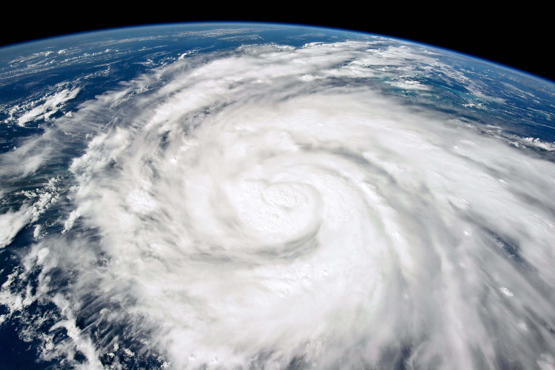
Hurricane Joaquin, in 2016, didn’t hit South Carolina, but it sat off the coast of South Carolina sending an atmospheric river of rain to South Carolina which, caused numerous dam breaks, blew a hole in the Columbia Canal nearly bringing Columbia’s water system to the brink of failure, and caused numerous deaths.

Reply
Facts June 4, 2023 at 8:00 pm

Were you expecting more from this blog?

Just the typical Republican talking points and the occasional russian propaganda.

Reply
Avatar photo
The Colonel Top fan June 5, 2023 at 6:52 am

Uhmmm, yeah, that was 2015….

Reply

Leave a Comment