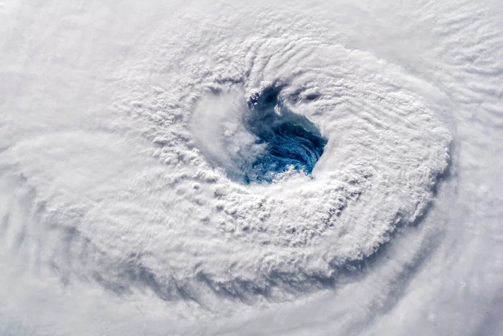
Hurricane season doesn’t officially start until June 1, 2022, but if we have learned anything in recent years it’s that these storms don’t wait for human calendars. Nor should we wait to get ready for them …
Researchers at Colorado State University (CSU) are projecting a busy 2022 season – including 19 named storms, nine (9) hurricanes and four (4) major hurricanes (i.e. storms with maximum sustained winds higher than 111 miles per hour).
If accurate, this would mark the seventh consecutive year with “above average” tropical activity … although as CSU professor Michael Bell noted there is a key caveat to that definition.
“It takes only one storm near you to make this an active season,” Bell said.
Speaking of, CSU researchers provided the following probabilities of major hurricanes making landfall:
- 71 percent for the entire U.S. coastline (average for the last century is 52 percent)
- 47 percent for the U.S. East Coast including the Florida peninsula (average for the last century is 31 percent)
- 46 percent for the Gulf Coast from the Florida panhandle westward to Brownsville (average for the last century is 30 percent)
- 60 percent for the Caribbean (average for the last century is 42 percent)
So if you are betting on storms … now you know the odds.
Last year’s season – which ran from May 22 through November 7 – yielded 21 named storms, seven (7) hurricanes and four (4) major hurricanes. That was the third-most active season on record – and the $80.63 billion in damage done by these systems also ranked third on the all-time list.
The previous season, 2020, was the most active hurricane season since records have been kept in the Atlantic basin. That year, records were tied for total depressions (31) and major hurricanes (7) while a new record was set for named storms (30). As far as its fiscal impact was concerned, 2020 was the fifth-costliest year on record – doing an estimated $51.14 billion worth of damage.
For those of you keeping score at home, 2020 also established a new record for named storms (11) which made landfall in the United States. It tied the record for named storms (10) which underwent “rapid intensification”- which equates to a 35-mile-per-hour increase in maximum sustained winds over a 24-hour period.
For the second year in a row, though, there were no category five storms – i.e. no storms with maximum sustained winds of 157 miles per hour or stronger (for those of you in need of a refresher on the Saffir-Simpson hurricane wind scale).

***
Driving the increased tropical activity is “the likely absence of El Niño,” CSU researchers suggested.
El Niño is the periodic warming of the central and eastern equatorial regions of the Pacific Ocean – while La Niña refers to the cooling of the Pacific that takes place in its aftermath. During El Niño years, hurricanes are less likely to form in the Atlantic due to increased wind shear. During La Niña, the potential for hurricane formation and rapid intensification is much stronger.
La Niña may “weaken and transition to neutral conditions by this summer” CSU researchers noted, but that hasn’t happened yet …
(Click to view)
(Via: Golden Gate Weather Services)
While Pacific waters remain cooler than usual, waters in the Atlantic are currently at normal temperatures – although things are a bit warmer than usual in the Caribbean.
“Tropical Atlantic sea surface temperatures are near their long-term averages, while Caribbean and subtropical Atlantic sea surface temperatures are warmer than their long-term averages,” CSU researchers noted. “The warmer Caribbean and eastern part of the subtropical Atlantic also favor an active 2022 Atlantic hurricane season.”
Obviously CSU isn’t the only game in town when it comes to projecting tropical activity. The taxpayer-funded National Oceanic and Atmospheric Administration (NOAA) has yet to release its official 2022 forecast – although that information is scheduled to be published next Tuesday (May 24, 2022).
South Carolina has seen 24 hurricane landfalls since 1893 – the most recent being Hurricane Matthew in 2016 and the most infamous being Hurricane Hugo in 1989 (the state’s last direct hit from a major system). The Palmetto State was nearly hit in 2020 by Hurricane Isaias (or, as governor Henry McMaster called it, Hurricane “Icy Isis”).
Other recent close calls included Hurricane Dorian in 2019 and Hurricane Irene in 2011.
***
RESOURCES …
(Via: NASA)
As you get ready for the upcoming season, be sure to check out the S.C. Emergency Management Division (SCEMD) – which will soon be releasing its annual hurricane guide. Additionally, SCEMD features a page devoted to hurricane evacuation zones – information which is incredibly important in the event of an evacuation.
I would also recommend following following SCEMD on Facebook and Twitter – as well as the National Weather Service (here and here).
For those of you interested in tracking the progress of tropical storm systems, be sure to bookmark the National Hurricane Center (NHC), Weather Underground and the Boat U.S. hurricane tracking and resource center for the latest data.
***
ABOUT THE AUTHOR …
(Via: FITSNews)
Will Folks is the founding editor of the news outlet you are currently reading. Prior to founding FITSNews, he served as press secretary to the governor of South Carolina. He lives in the Midlands region of the state with his wife and seven children. And yes, he has LOTS of hats (including that Minnesota Twins’ lid pictured above).
***
SOUND OFF…
Got something you’d like to say in response to one of our articles? Or an issue you’d like to address proactively? We have an open microphone policy! Submit your letter to the editor (or guest column) via email HERE. Got a tip for a story? CLICK HERE. Got a technical question or a glitch to report? CLICK HERE.
BANNER VIA: NASA


